Levees in distress

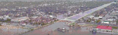
One of the more worrisome things I read in the online Times-Picayune (http://www.nola.com/) in the months following Hurricane Katrina was the discovery that, in addition to the failed levees, there were several sections that were "distressed". The most disturbing of these to me was one located on the west (Metairie) side of the 17st Canal; i.e., on the side of the canal where my parents and brother and other family and several hundred thousand other people live. So when I visited in December 2005 I took a day off from replacing sheetrock in my parents flooded home (yes Virginia, parts of Metairie flooded too) and walked the west (Metairie) side floodwall on the 17st Canal.
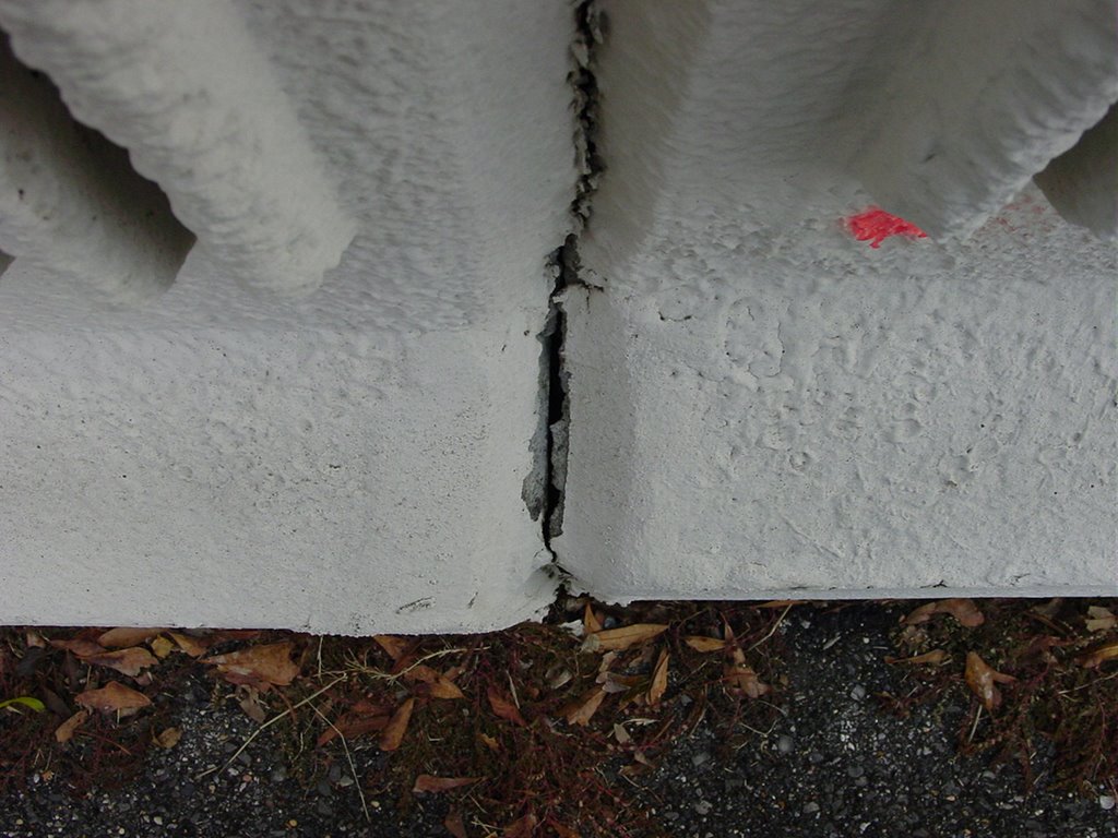
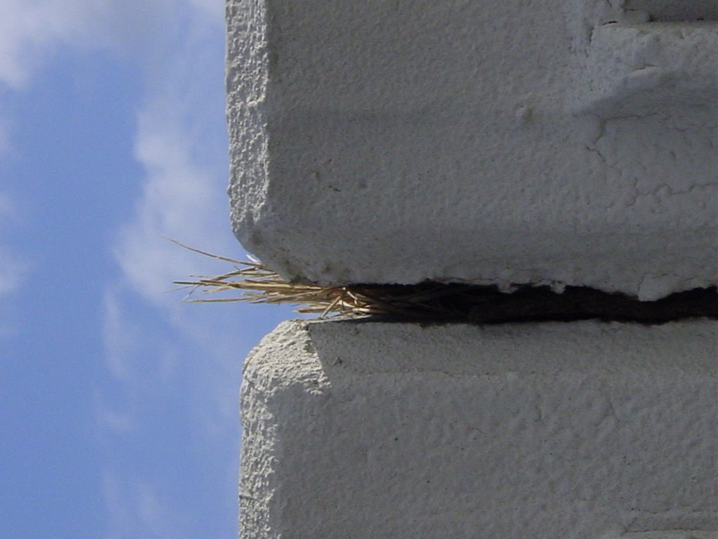
The photos above show small but significant displacements between two sections of floodwall on the west (Metairie) side of the canal. They don't look like much, but they are larger than the gaps between any of the other floodwall sections. John Rogers, one of the members of NSF's Independent Levee Investigation Team, found the same section but was smart enough to get on top of the floodwall to take his picture. I guess that's why he's the earthen dam/levee expert and I'm just an earthquake chaser.
 Why does this matter? Two reasons, one fortunately hypothetical and the other very real. First, if the west (Metairie) side levee of the 17th Street Canal had given way before the east (Orleans) side, a vastly larger part of the New Orleans metro areas floods. Orleans Parish's fate is already sealed by the London Avenue levee breaches, but a breach on the west (Metairie) side of the 17th Street Canal floods all of the East Bank of Jefferson Parish. More people die, more homes and businesses are destroyed, and basically New Orleans is even more screwed than it actually was. More people need to rescued, but staging areas like Zephyr Field and triage/evacuation centers like the Louis Armstrong Airport are under water. Think of it this way: more people need help but help has alot harder time getting to them. That ~10,000 dead number starts to look more like a realistic estimate under those conditions.
The second thing that concerns me is this: Do we know where all the other weak/distressed levee sections are? Some, like near Lake Vista Drive in Kenner, are known weak points and are getting some attention. But are there others? What tale do the rest of the geotechnical boreholes tell? Are there enough of them to really characterize the geology beneath the levee system?
Yeah, I know, I am probably overdoing it. But I never expected that a category 3 hurricane would produce seven major levee failures. One would have been bad and two disasterous. Seven? Ouch!
posted by Renegade Seismology @ 7:46 PM
![]()


<< Home